Geophysical Surveying
Geophysical Surveying
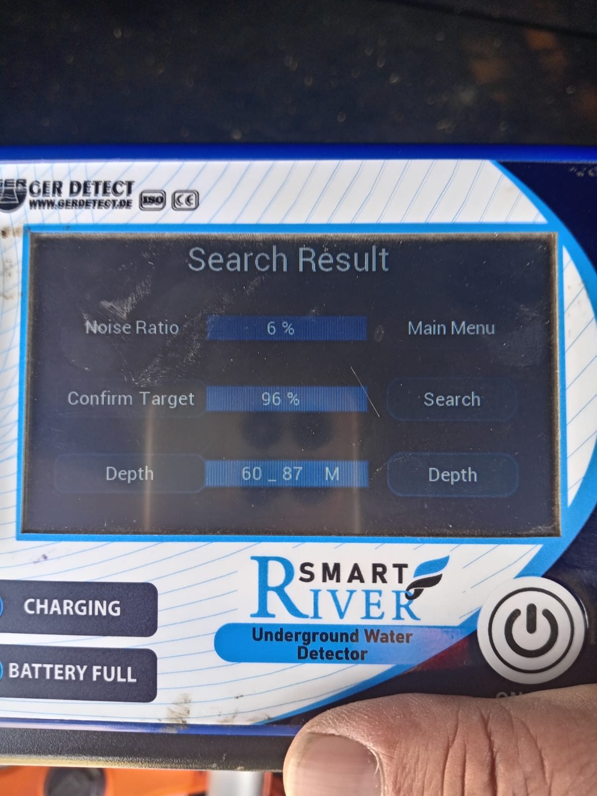
HVGS offers advanced geophysical surveys to optimize drilling and resource planning. Our technologies help locate groundwater, assess aquifer capacity, and mitigate drilling risks.
Survey Capabilities:
-
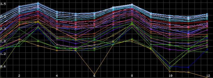
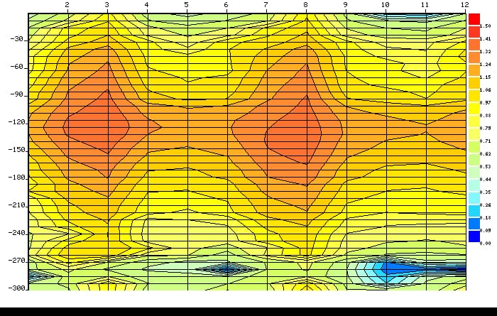
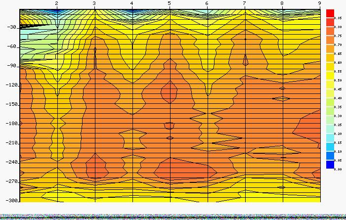
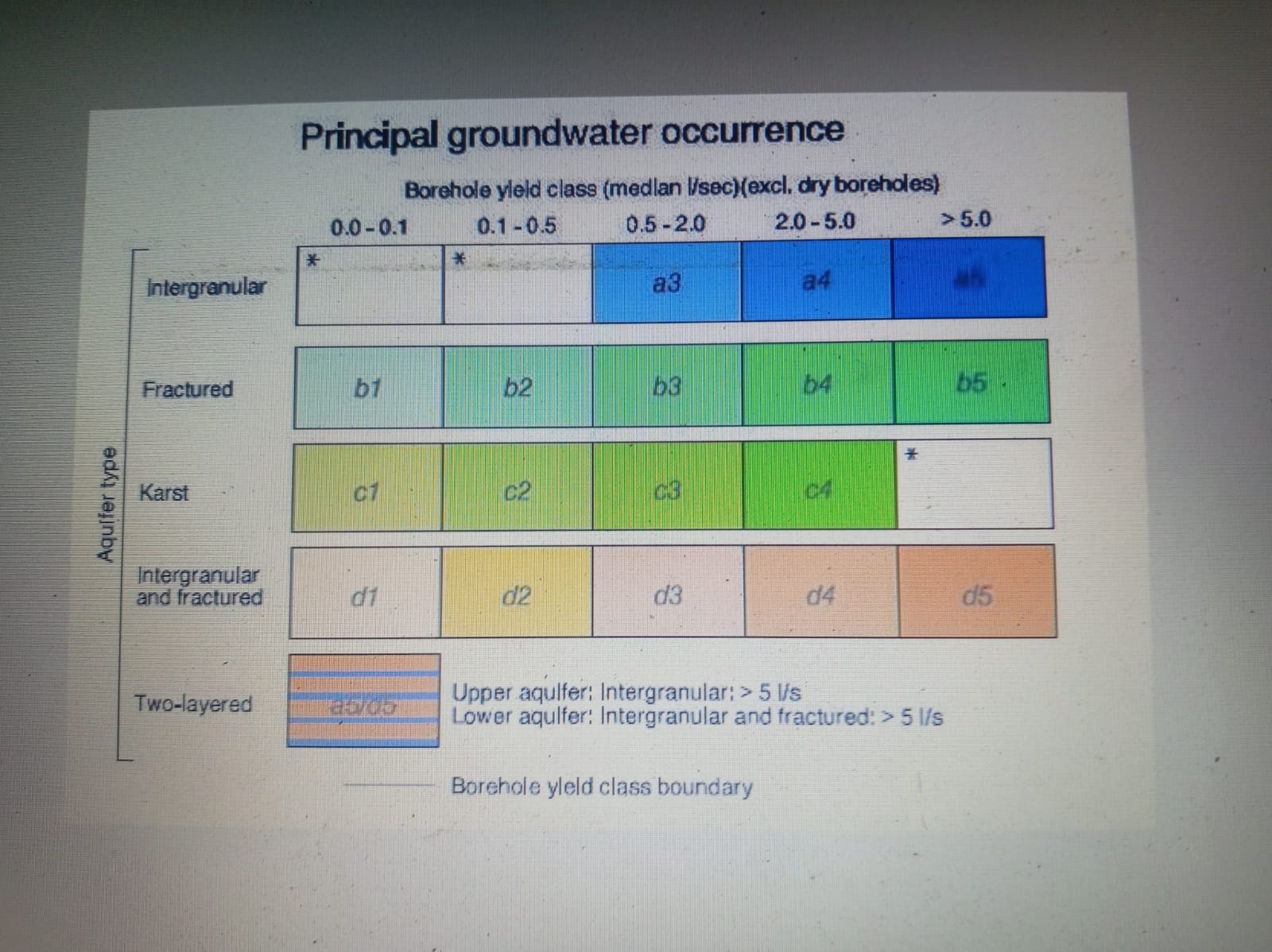
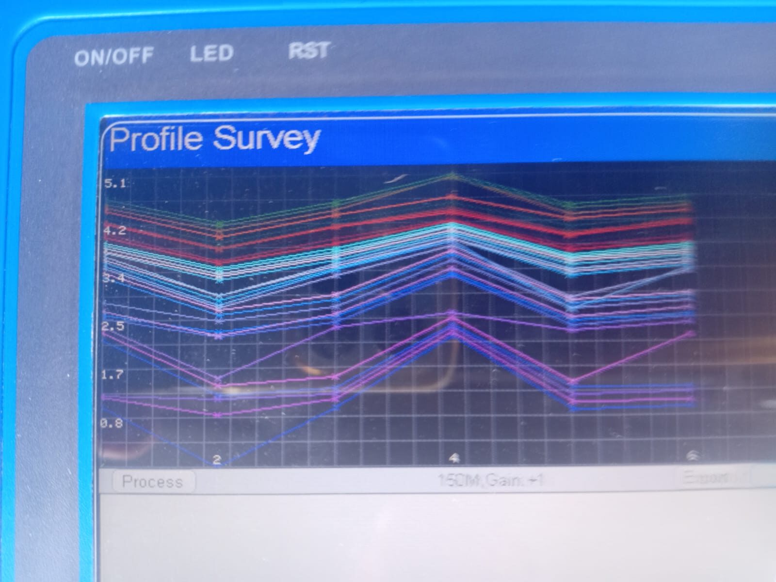
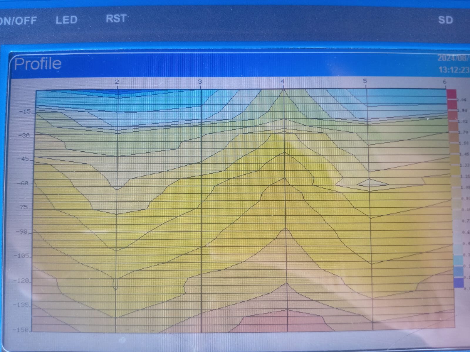
Electromagnetic (EMT) Surveys – To identify subsurface water-bearing zones.
-
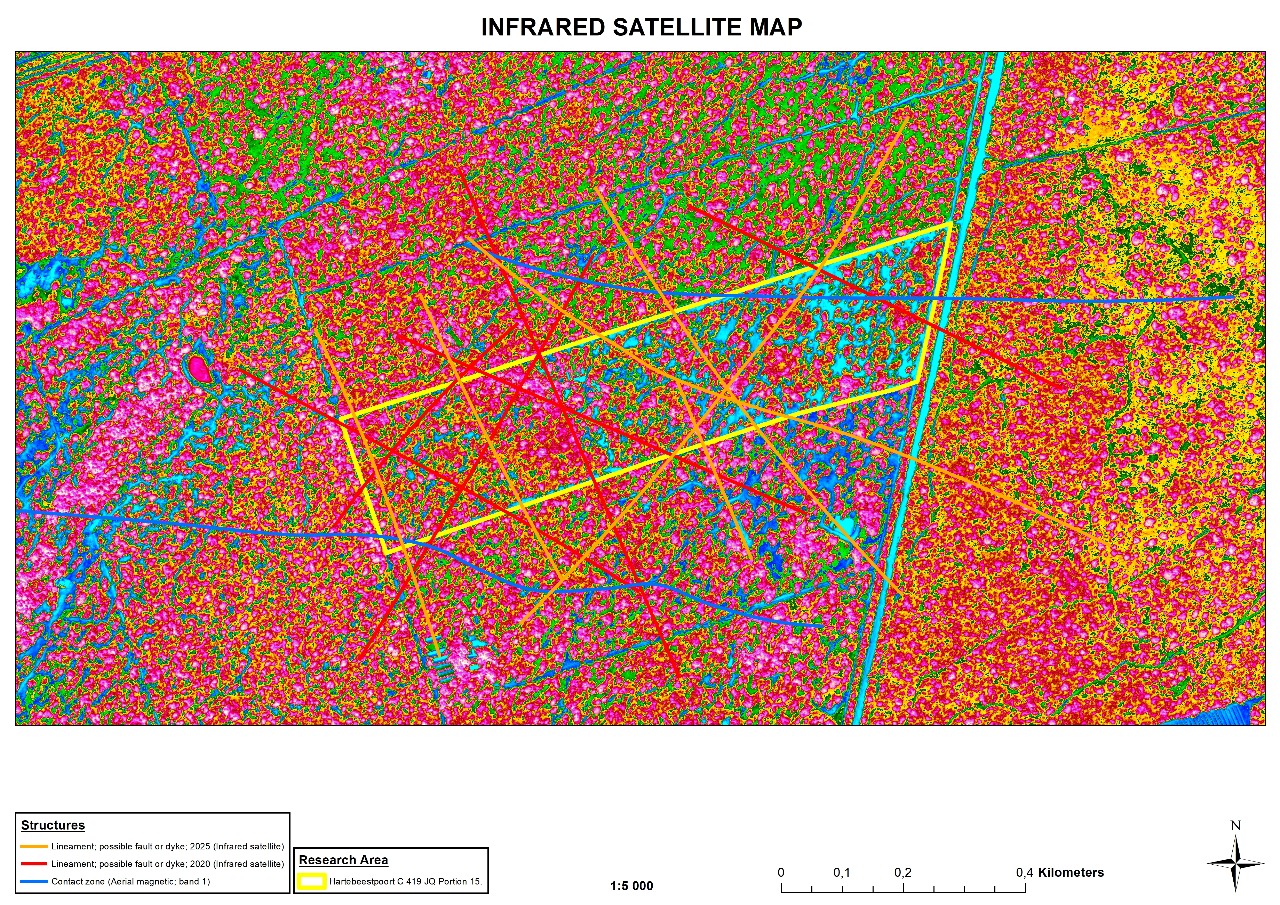
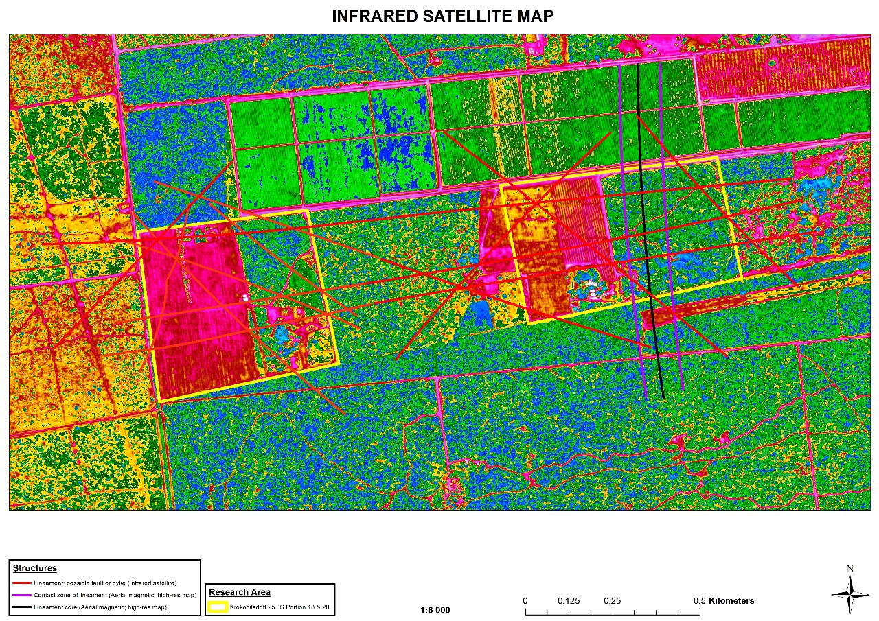
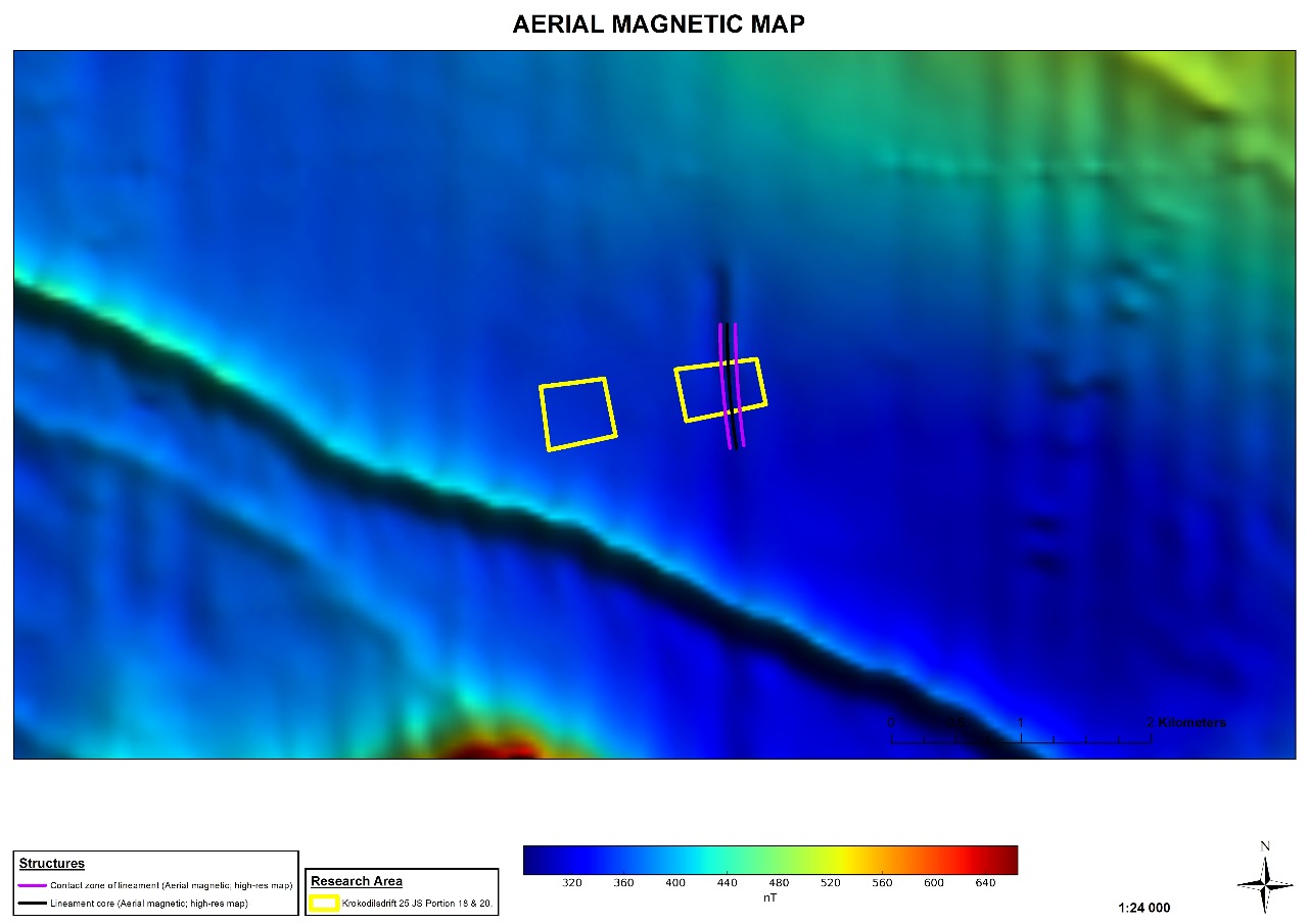
Aerial Magnetic Mapping – Helps detect geological structures, fractures, and fault zones relevant to water and mineral exploration.
-
Infrared Satellite Imaging – Monitors soil moisture, vegetation stress, and hydrological features.
-
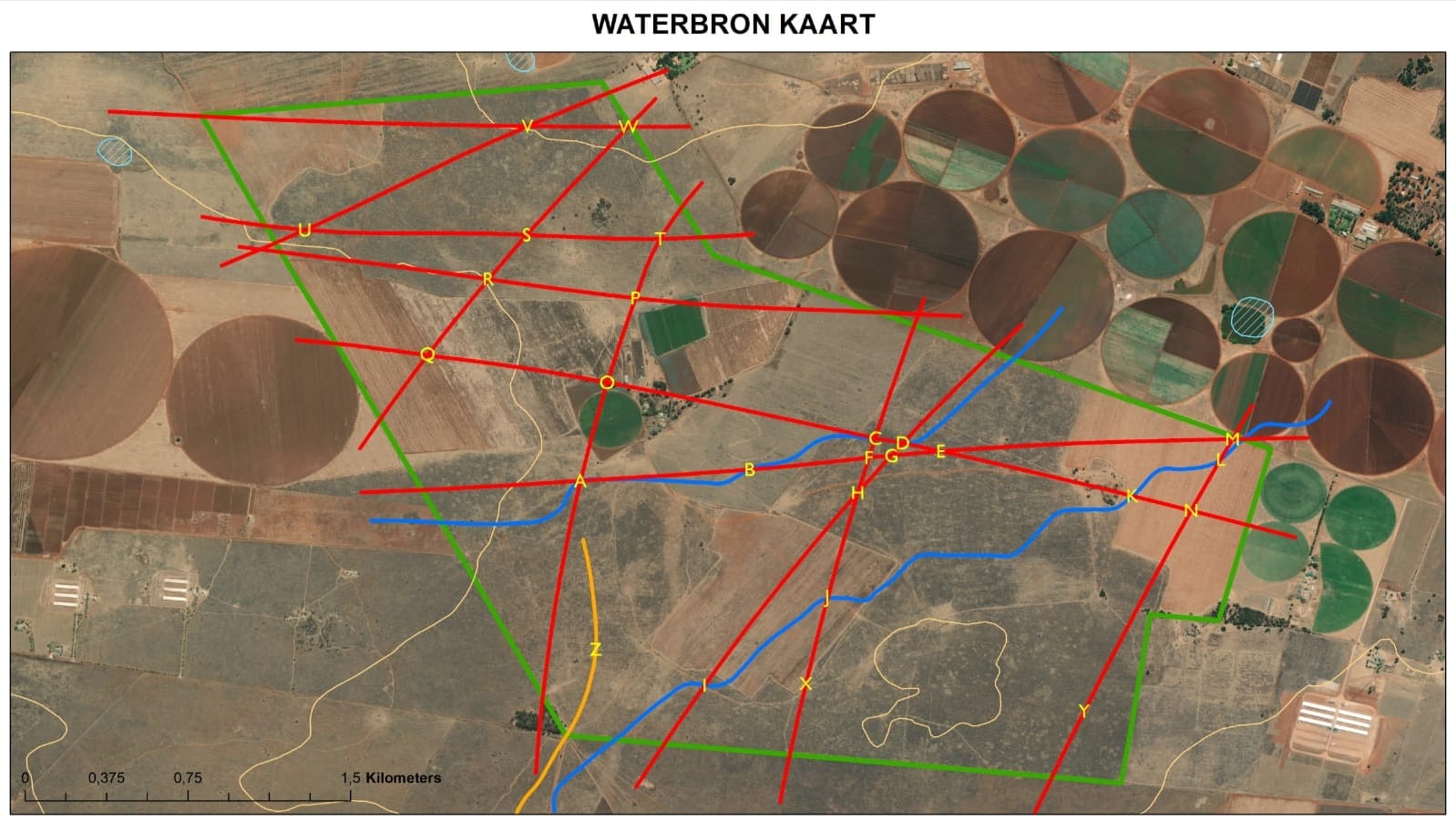
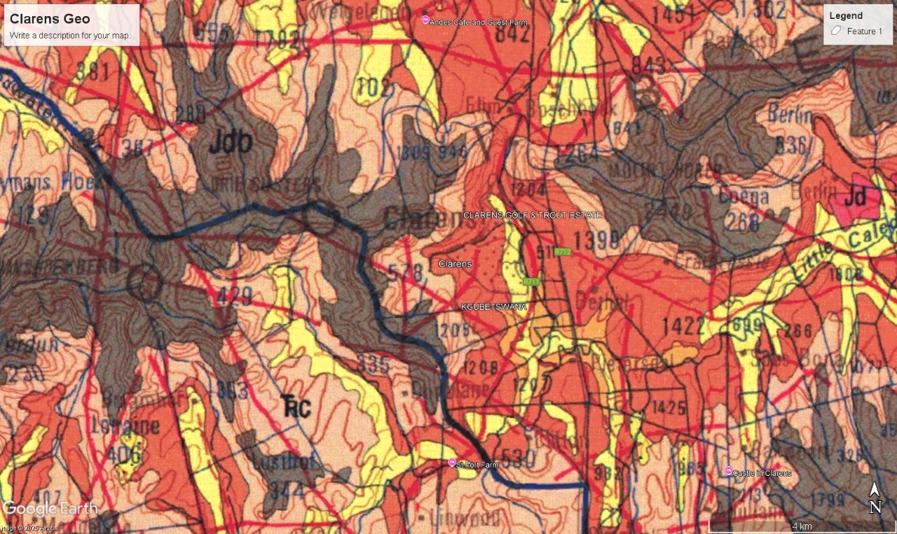
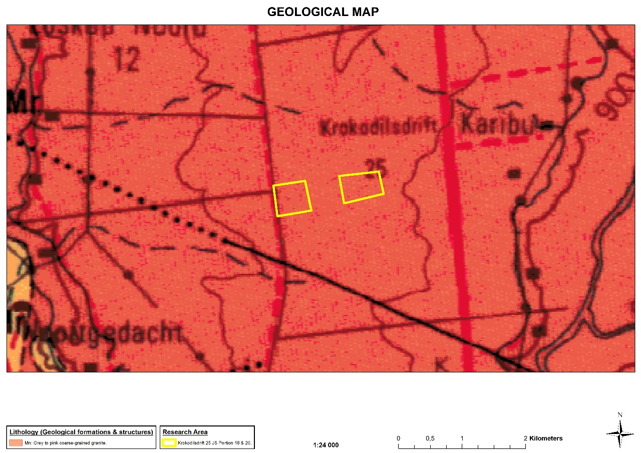
Geological & Hydrogeological Mapping – Detailed maps to guide drilling and infrastructure development.
-
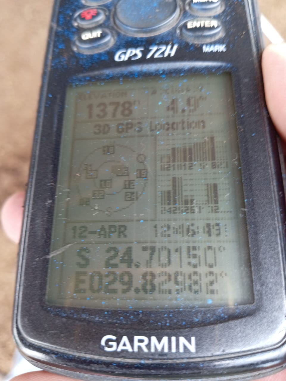
GPS Positioning & Site Planning – Ensures drilling precision and efficient project execution.
✅ Key Benefit: Our surveys reduce failed boreholes, save costs, and provide reliable data for long-term resource management.
Testimonnials
“HVGS delivered outstanding groundwater exploration services for our mine site. Their drilling team worked efficiently under very challenging conditions and completed the project ahead of schedule. Their commitment to safety and quality gave us complete peace of mind.”
“The geophysical survey conducted by HVGS was critical for our aquifer recharge program. Their data accuracy and clear reporting allowed us to make informed decisions about sustainable water sourcing for the community.”
“Thanks to HVGS, we now have a reliable solar-powered irrigation backup system. Their turnkey approach, from design to installation, was seamless and professional. Our farming operations can now continue uninterrupted, even during water supply challenges.”